Interactive maps and operating times

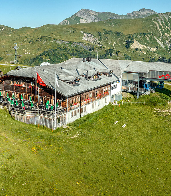
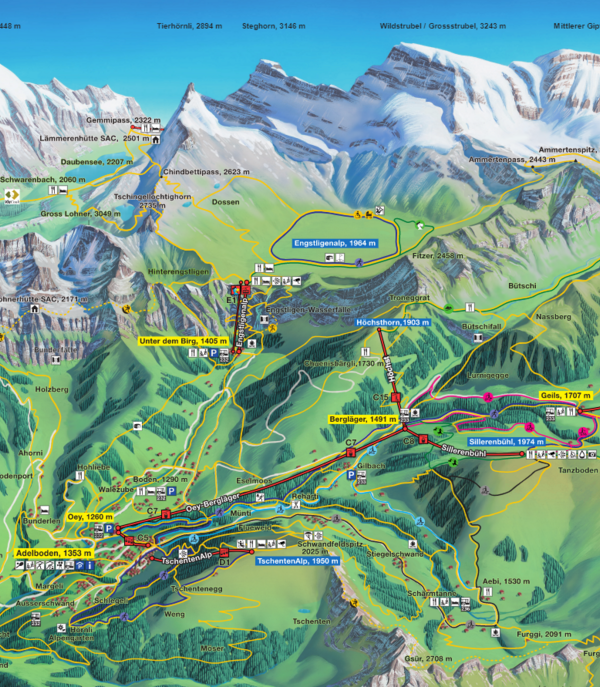
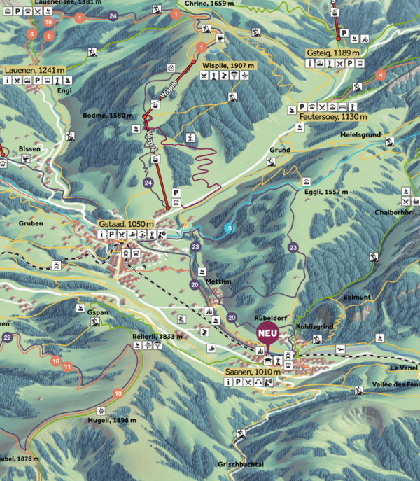
Adelboden-Lenk mountain cablecars

4 Facilities

Welcome to Lenk-Simmental and the Adelboden-Lenk ski region. Excellent pistes at the foot of the Wildstrubel eagerly await discovery. The Betelberg shines with wide and open pistes for enjoyable carving. In the Metsch-Bühlberg ski area you are right in the heart of Adelboden-Lenk...Dänk!

Mountain railways
Lenk - Stoss
Gondola lift
closed
Stoss - Leiterli
Gondola lift
closed
Stand-Xpress I
Gondola lift
closed
Stand-Xpress II
Gondola lift
closed
Winter hiking trails
AlpRundweg Leiterli
closed
Alpenblumenweg Betelberg seit 1989
closed
Ey - Iffigfall
closed
Höhenrundweg Gryden
closed
Iffigenalp - Wildstrubelhütte
closed
Leiterli - Gryden - Wallegg - Lenk
closed

At the start, the trail runs along the same route as the Gryden high-altitude trail. You can enjoy a fantastic view of a crater-like landscape. At the end of these lunar landscape-like rock formations, you reach the Trütlisberg Pass. From here, the hiking trail leads steadily downhill across alpine meadows and forests towards Lenk. Directly at the Wallegg mountain restaurant, the path branches off to the left into the spectacular Wallbach Gorge. Continue back to the village centre of Lenk.

Hiking time: 4 hours

Ascent: 147 metres in altitude
Descent: 1014 metres in altitude

Start: Leiterli mountain station
End: Lenk railway station

Leiterli - Iffigsee - Iffigenalp
closed
Leiterli - Stoss
closed
Leiterli - Stoss - Lenk
closed

La première partie de la randonnée mène de la station supérieure de Leiterli à la station intermédiaire de Stoss en passant par des prairies alpines avec de nombreuses fleurs de montagne. Jusqu'ici, le chemin est modérément raide et se compose de sentiers de randonnée et de routes en gravier. De la station intermédiaire, un chemin de randonnée un peu raide passe principalement par la forêt et redescend dans la vallée jusqu'à la station aval de Betelberg.

Temps de marche : 2h
Descente : 847 mètres de dénivelé

Début : station amont Leiterli
Fin : station aval Betelberg

Lenk - Bühlberg
closed
Lenk - Simmenfälle
closed
Luchs-Trail
closed
Metsch - Tannenbühl - Bühlberg
closed
Murmeli-Trail
closed
Rundweg Steinstoss
closed
Veloweg Lenk – Simmenfälle
closed
Veloweg Lenk – Zweisimmen
closed
Metschstand - Bergläger (Zubringer Höchst-Trail), retour via Sillerenbühl/Hahnenmoos
closed
Lenk – Iffigenalp
closed
Hahnenmoos – Metschmaad – Bühlberg – Lenk
closed
Lenk – Leiterli – Summerwald – Lenk
closed
Panoramic route Metschhore - Langermatte
closed
Lenk – Trüttlisbergpass – Turbach – Gstaad
closed
Miscellaneous
Alpine play area at Leiterli
closed
Alpkultur play area Lenkerseeli
closed
BoulderSchüür
closed
Paraglider launch site Metschstand
closed
Paraglider launch site Mülkerblatten
closed
Play with alpine soundscapes
closed
Tourist Center Lenk
closed
Wallbach bath
closed
Car parks
Parking Betelberg
Show on Map
closed
Parking Betelberg
Show on Map
closed
Parking Bühlberg
Show on Map
closed
Parking Rothenbach
Show on Map
closed
Parking Wallegg
Show on Map
closed

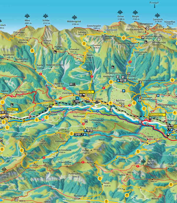
Interactive panoramic map

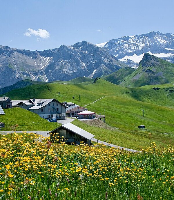
Operating times & hiking information Lenk

Operating hours Simmental, Adelboden & Saanenland

The meteorological conditions in the mountains can change quickly. Please note that natural influences can affect the accessibility of paths and can also lead to changes at short notice. If in doubt, please contact the Tourist Centre Lenk on +41 33 736 35 35.